

Moel Morfydd [Llantysilio Mountain]
Good walks are even better shared.
SJ1645 : Mynd i lawr Foel Morfydd / Descending Moel Morfydd
Alan Richards Photo source
Overview
Moel Morfydd [Llantysilio Mountain]
Introduction
Moel Morfydd, an enchanting Marilyn standing proudly at 533 meters, is a delightful hill nestled in the Llantysilio Hills of North Wales. With its charming elevation and stunning panoramic views, it beckons hikers of all abilities.
Geology
This hill is primarily composed of mudstone and sandstone, showcasing fascinating sedimentary formations. Glacial activity has contributed to the enchanting shape of the hills around, while the hidden shale outcrops resiliently hold their ground against time.
Getting There
Access is relatively easy. Park your car at the Llantysilio Car Park (SJ 158 457), a fantastic kick-off point for your adventure!
Recommended Routes
- Llantysilio to Moel Morfydd Circular: An 8-km route that loops through beautiful scenery, moderate in difficulty but rewarding in views. Expect to invest around 3.5 hours.
- Offa's Dyke Path: For avid walkers, a stretch of this iconic path runs alongside the slopes of the hill. Approximately 9.5 km long, this moderate route will take about 4 hours to complete.
Summit Experience
Upon reaching the summit, you'll find a sizable cairn and a trig point. A perfect spot for a celebratory snack or a dramatic pose for the ‘gram! The views open up like the pages of a storybook with the Vale of Llangollen unfurling before you.
Terrain Type
The terrain is a delightful mix, with grassy slopes leading to rocky outcrops and a couple of boggy patches as you near the summit. Be ready for whatever Mother Nature might throw at you!
Seasonal Highlights
Spring and autumn are when Moel Morfydd shines its brightest. In spring, the wildflowers form a carpet of colour, while autumn brings a rich tapestry of rustling leaves.
Hazards
Be cautious of the weather, which can be quite moody – what’s the saying? “If you don’t like the weather, wait five minutes!” The path can be a tad slippery and boggy at times, so sturdy footwear is essential.
Nearby Summits
Don't forget to explore nearby summits like Moel Fferna (618 m) and Dinas Brân (376 m), both of which are steeped in their own tales of beauty and adventure.
Conclusion
Moel Morfydd is not just any hill; it’s a treasure waiting to be discovered, promising an adventure filled with breathtaking views, rich history, and perhaps a few sheep crossing your path. So lace up those boots and prepare for an unforgettable journey!
Explore routes near Moel Morfydd [Llantysilio Mountain]
Walks starting near this hill. Open a route to check its map, distance and full itinerary.
Llangollen to Horseshoe Falls: Canal Towpath from Market Street
View route
World’s End and back
View route
Oswestry Walk with Men Walking & Talking
View route
Alwen Reservoir: full waymarked lakeside circuit
View route
Route planning notes
These notes describe possible approaches. Check a route's map and access information when planning your walk.
Llantysilio to Moel Morfydd Circular
A picturesque circular route starting from the village of Llantysilio that offers stunning views and a varied terrain, leading you gently up to the summit.
Offa's Dyke Path
A stretch of the famous Offa's Dyke path that navigates the slopes of Moel Morfydd, providing both history and beauty.
Make a day of it, together
Find someone to share the walk with, or organise a day out along a route you like.
Photo Gallery
View all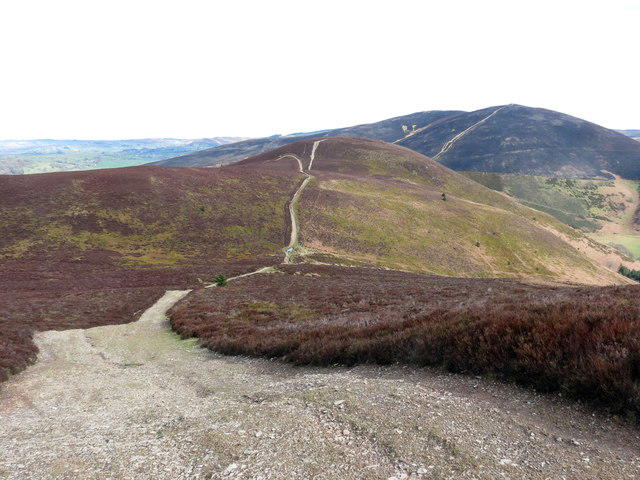 Photo could not load
SJ1645 : Mynd i lawr Foel Morfydd / Descending Moel Morfydd
Alan Richards
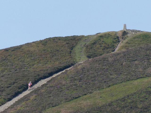 Photo could not load
SJ1645 : Walker ascending to the summit of Moel Morfydd
Jeremy Bolwell
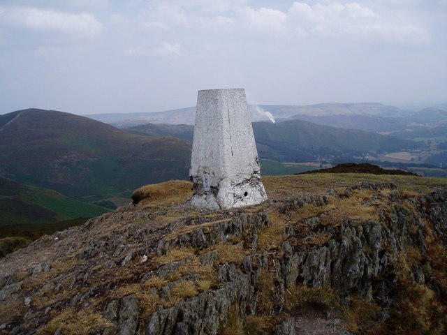 Photo could not load
SJ1545 : Moel Morfydd
Eirian Evans
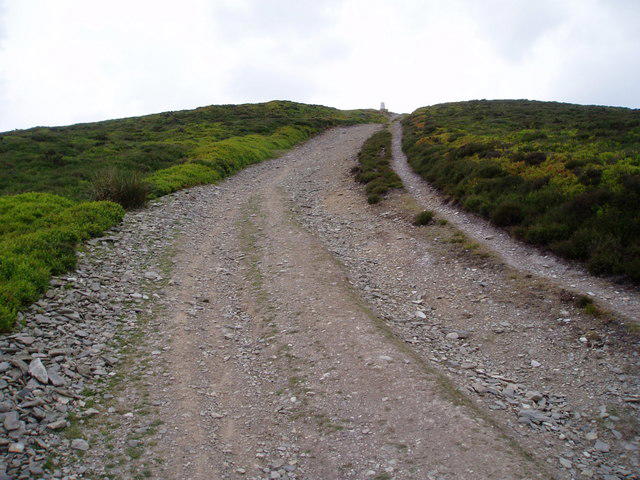 Photo could not load
SJ1645 : Nearly there
Eirian Evans
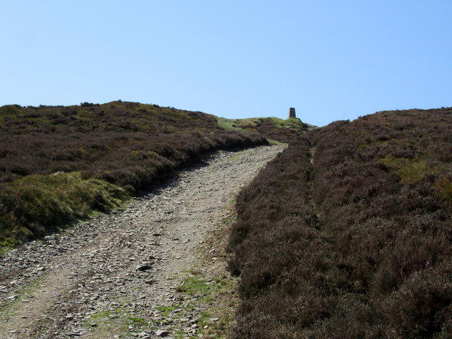 Photo could not load
SJ1645 : Nearly there!
John H Darch
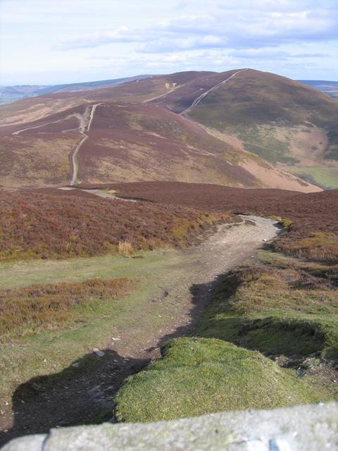 Photo could not load
SJ1545 : The Summit of Moel Morfydd and the View along Llantysilio Mountain
John S Turner
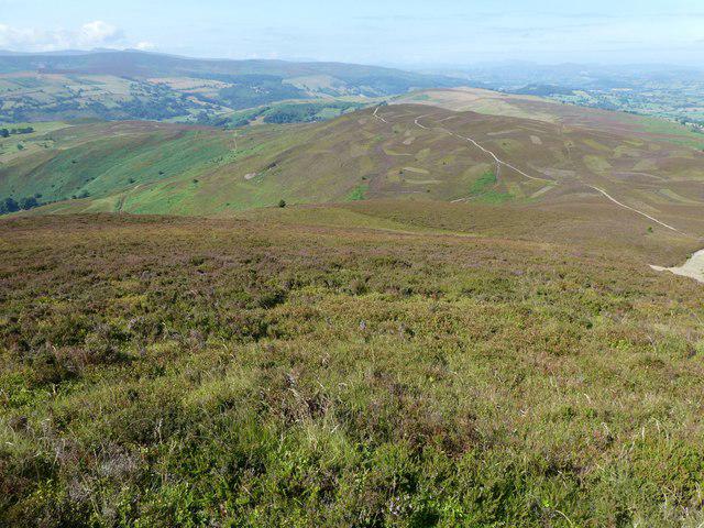 Photo could not load
SJ1545 : View westward from the top of Moel Morfydd
Jeremy Bolwell
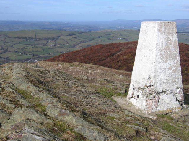 Photo could not load
SJ1545 : The Summit and Trig Pillar of Moel Morfydd
John S Turner
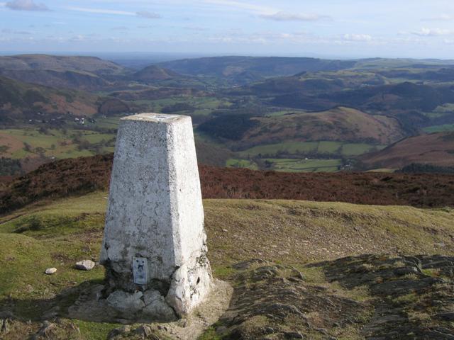 Photo could not load
SJ1545 : The Summit and Trig Pillar of Moel Morfydd
John S Turner
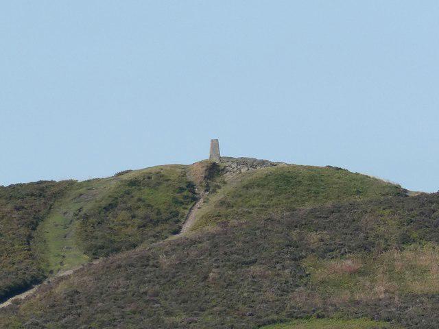
SJ1545 : Summit of Moel Morfydd from the summit of Moel y Gaer
Jeremy Bolwell
Hill facts and local notes
Classifications
Elevation
550m
1,803 ft
Prominence
115m
Coordinates
53.0026, -3.2537
SJ159457
OS Map
116
Explorer: 255 256
At the Summit
The summit features a prominent cairn and a trig point, offering a great photo opportunity for those triumphant at the top. Don't forget to take a selfie with the stunning backdrop!
Terrain & Geology
Composed mainly of mudstone and sandstone, the hill exhibits fascinating sedimentary features with occasional outcrops of shale where the rocks are more resistant to erosion. Not to forget the scenic glacial valleys nearby, making for a splendid geological contrast.
Views & Scenery
The spectacular views include the Vale of Llangollen, the rolling hills to the south, and even glimpses of Snowdonia on clear days. It's quite the postcard from up there!
History & Heritage
Name Origin
The name 'Moel Morfydd' translates to 'Hill of the Beautiful Woman' in Welsh, hinting at the legends that surround this enchanting place.
Historical Significance
Moel Morfydd is part of the ancient landscape that holds cultural history, often linked to local folklore and stories of the past.
Getting There & Facilities
Parking
There is parking available at the Llantysilio Car Park (SJ 158 457) which is a great starting point for the routes mentioned.
Public Transport
Buses from Llangollen can take you to Llantysilio, with a short walk to the trailhead.
Nearby Facilities
Cafés and pubs are available in Llangollen for a well-deserved break after tackling the mountain. There's also public toilets near the car park.
Safety Information
Known Hazards
- Be mindful of sudden weather changes that can turn from sunny to rainy in a tick. Some parts can also be boggy, so sturdy footwear is recommended!
General Safety Tips
- Check weather conditions before setting out
- Carry appropriate clothing and equipment
- Let someone know your planned route
- Take a map, compass, and GPS device
- Carry emergency supplies: food, water, first aid kit, torch
Hills
Some common questions about the hills answered
Are there group walks up Moel Morfydd [Llantysilio Mountain]?
Many walkers use Walkmates to join or organise walks with others. You can check for group walks around Moel Morfydd [Llantysilio Mountain] through the maps
Are there other walkers around Moel Morfydd [Llantysilio Mountain]?
Activity varies by location and time, but Walkmates lets you see whether others have shared walks or shown interest in this area. Find other people through the walking friends search walking friends for Moel Morfydd [Llantysilio Mountain] search or of course create your own walk for Moel Morfydd [Llantysilio Mountain]
Can I organise a walk to Moel Morfydd [Llantysilio Mountain]?
Yes. If there aren’t any walks listed already, you can create a walk and make it available for others to join.
If you're signed up to Walkmates, you can create a walk to Moel Morfydd [Llantysilio Mountain].
How do I find a walk up this hill?
There are often multiple ways to walk this hill, depending on experience and route preference. Walkmates helps you explore walks and routes that others have shared.
Can I suggest a new route up Moel Morfydd [Llantysilio Mountain]?
Yes. You can suggest or create routes to share with others. Walkmates focuses on the social side of walking, so routes are used to help people organise walks and explore areas together, rather than as detailed navigation tools or route libraries.
Other uses really appreciate knowledgeable walkers sharing their routes. Share your favourite route to Moel Morfydd [Llantysilio Mountain] here
The is an error or something incorrect about this hill. How do I let you know?
We always strive to keep the information on Walkmates as accurate as possible. If you find an error, please let us know through the contact form and we'll aim to correct it as quickly as possible
Community Discussion
Comments
Location
![Moel Morfydd [Llantysilio Mountain] location map](https://cdn.walkmates.com/hill-maps/hill-sources/3353/53.00259_-3.25370.png)
Grid reference: SJ159457
View on OpenStreetMapOpens a map in a new tab, centred on the hill.
No comments yet. Be the first.